Essay Fishing Regulations
Federal Waters Striper Rules Near the Bay Mouth
Boats must know whether they're in state or federal waters, as stripers are banned in the EEZ.
Fishing near the Chesapeake Bay mouth requires more than knowing a striper slot limit. Where the boat is fishing determines which rules apply, because state-water permission ends at a federal boundary where targeting and possession are prohibited. That boundary, rather than the size of the fish, must govern boat positioning, fishing decisions and any route offshore.
Why the Bay mouth is the most legally complicated stretch of water on the Atlantic striper coast
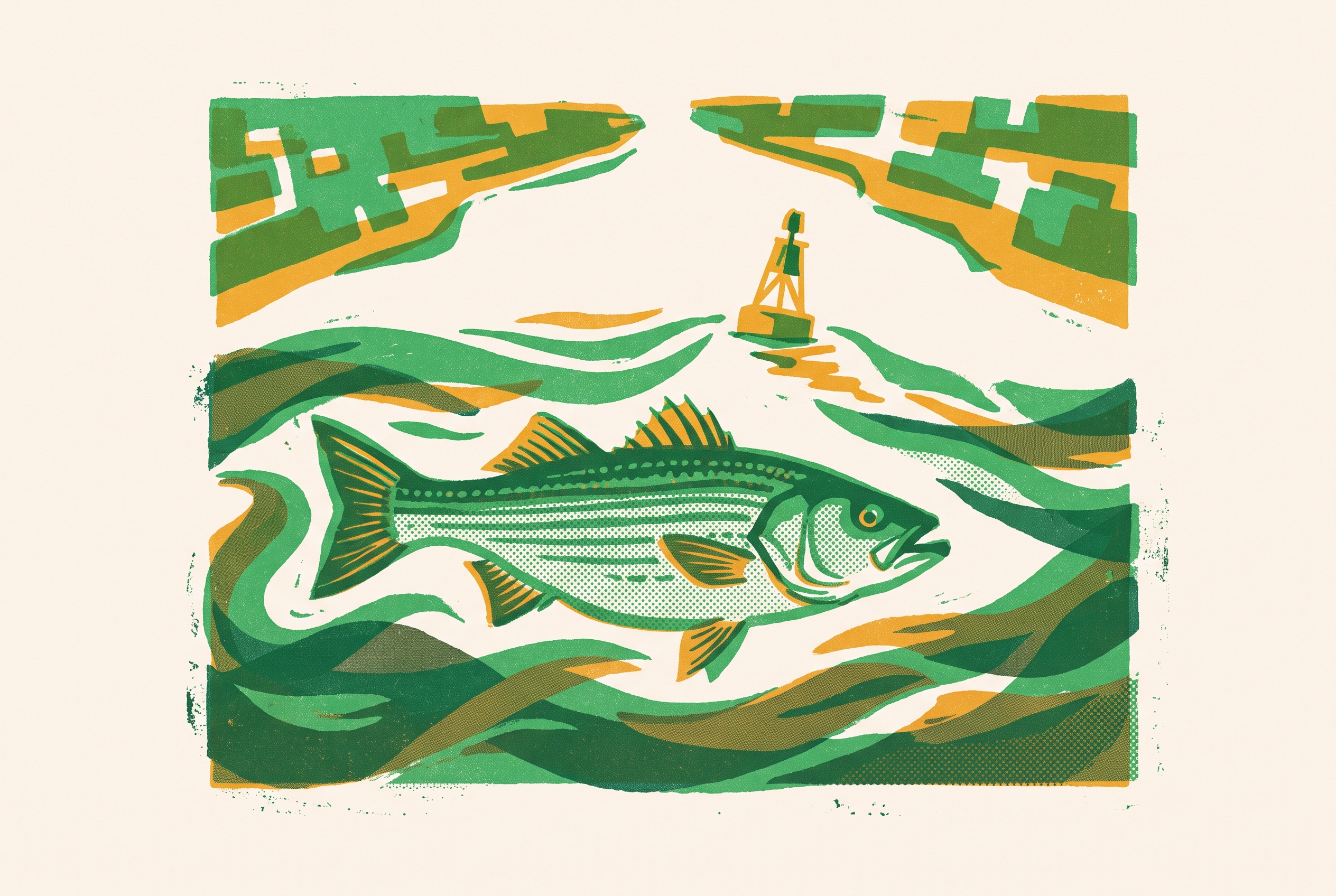
A boat trolling near the mouth can drift with the tide or wind while its crew remains focused on the lines. In state waters, fishing must follow the rules for the season and area, along with the slot and bag limit. Across the federal boundary, those permissions no longer apply. Fishing in federal waters is still unlawful even if the fish is within the state slot or the crew releases a fish it deliberately targeted.
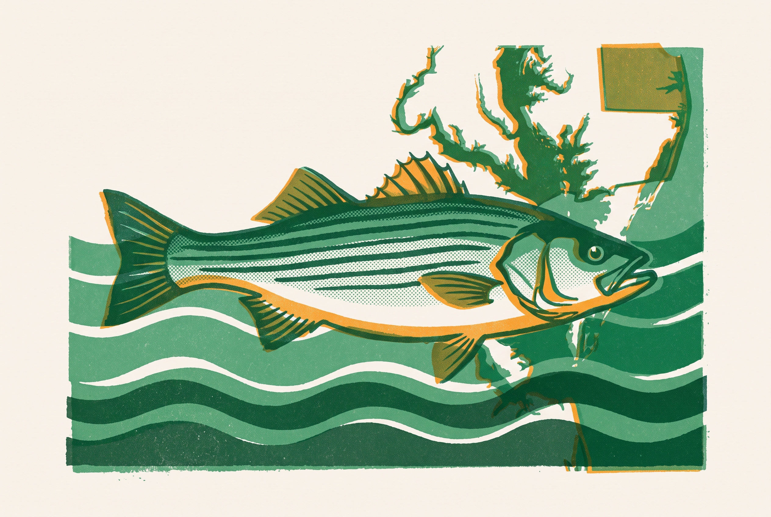
The Virginia capes bring state rules, federal restrictions and seasonal closures into a small area. They also separate Chesapeake Bay waters from Virginia’s coastal ocean waters, which have different state rules. A run toward offshore wrecks or structure can therefore cross more than a geographic boundary. It can change both the governing jurisdiction and the kind of fishing allowed, without any visible signal on the water.
Where state jurisdiction ends and federal waters begin near the Virginia capes
The practical fisheries boundary is generally 3 nautical miles offshore, while the outer edge of the Territorial Sea is roughly 12 nautical miles from the baseline. Those lines serve different legal purposes and must not be treated as interchangeable. NOAA’s Greater Atlantic recreational rules describe the federal striped-bass closure as beginning generally 3 miles offshore and extending to the outer boundary of the EEZ. The EEZ extends to 200 nautical miles offshore.
Virginia’s regulations define the “Three Nautical Mile Limit” as the offshore limit of state waters in the belt adjacent to Virginia’s coast and seaward of the mean low-water mark. At the Bay entrance, the line between Cape Charles and Cape Henry also matters because it separates Bay water from coastal ocean water. Water inside that entrance is subject to the applicable Bay rules. Virginia’s coastal ocean water inside the federal boundary is a separate state fishing area with rules separate from the Chesapeake Bay season.
This is the map an angler needs before deciding whether a location is open. Maryland and Virginia govern their respective Chesapeake Bay and tributary waters, while the federal closure governs beyond the offshore state boundary. No buoys or markers announce that transition. Boats working shoals outside the capes or running toward offshore structure must therefore distinguish the Bay entrance from the federal fisheries line.
What the federal EEZ prohibition actually says and what it forbids
50 C.F.R. § 697.7(b) makes it unlawful to possess any striped bass in or from the EEZ. That wording is broader than a prohibition limited to fish caught there. It does not establish an offshore slot or allow a small bag. Possession itself is restricted, and a fish’s lawful origin in state waters does not, by itself, establish a general right to carry it through closed federal waters.
That distinction matters because catching a fish and transporting it are separate legal questions. The specific Block Island transport provision addresses that problem in a defined location. It should not be read as evidence of an unrestricted coastwide transit allowance.
NOAA has prohibited Atlantic striped-bass targeting in federal waters since 1990. NOAA’s Greater Atlantic recreational rules state that recreational striped-bass fishing is prohibited there, so catch and release is not an alternative federal season. An unintended striped bass strike while someone is fishing for another species is distinct from targeting.
The one exception to the EEZ closure and why it does not help Bay mouth anglers
The Block Island Sound provision is geographically confined and permits transport. Within that Transit Zone, anglers may carry legally caught state-water striped bass between adjoining state waters and mainland ports while under continuous power. The provision does not create an EEZ fishing season or authorize stopping to target stripers.
No equivalent provision is identified for the Virginia capes or the Chesapeake Bay mouth. An angler cannot transfer the Block Island allowance to a route off Virginia simply because both trips involve a state-water fish. Talk of opening the Block Island area also leaves the current Bay mouth rules unchanged.
The Virginia capes bring state rules, federal restrictions and seasonal closures into a small area.
What the rules look like on the state-water side of the line in 2026
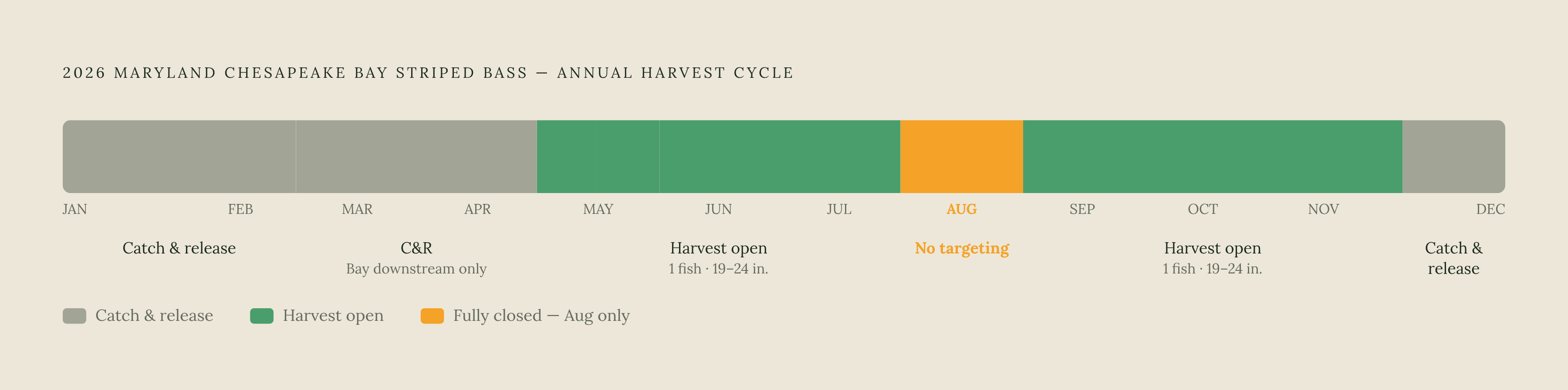
Maryland DNR’s 2026 regulations map sets out a seasonal schedule for Chesapeake Bay and tidal tributaries, with separate schedules for the Susquehanna Flats, Lower Susquehanna River and Northeast River. January 1 – February 28 allows catch and release only in all areas covered by the general schedule, and eels may not be used as bait. From March 1 – April 30, catch and release is allowed only in the Bay downstream of the Abbey Point–Worton Point line to Virginia, including Tangier and Pocomoke Sounds. Spawning rivers and the Upper Bay spawning area are off limits during that time. Stinger hooks are prohibited, trolling requires barbless hooks and no more than 6 lines, and eels remain prohibited as bait.
May 1 – May 15 opens harvest from the Brewerton Channel to the Virginia line, excluding most tributaries and other enclosed waters. The exceptions include Tangier and Pocomoke Sounds and Potomac River tributaries downstream of the Nice Memorial Bridge. Maryland DNR’s map specifies 1 fish per person per day, at least 19 inches and no more than 24 inches. Stinger hooks remain prohibited, and trolling requires barbless hooks.
May 16 – May 31 opens the Bay downstream of the line from the south corner of Hart-Miller Island Dike to the end of MD Route 21 at Tolchester, continuing south to the MD/VA line. Most tributaries remain excluded, with exceptions for Tangier Sound, Pocomoke Sound and specified portions of several river systems. For the Chester River, the tributary boundary runs from Hail Point to Long Point to Ferry Point. The Patuxent River tributary boundary runs from Point Patience to the west point of land at the entrance of Little Kingston Creek, while the Choptank River tributary boundary runs from Holland Point to the west entrance of Chapel Creek. Potomac River tributaries downstream of the Nice Memorial Bridge are also included, and the allowance is 1 fish per person per day within the 19–24-inch slot.
June 1 – July 31 opens all areas under the general schedule with 1 fish per person per day and a 19–24-inch slot. From August 1 – August 31, all those areas are closed to striped-bass fishing, even if anglers only try to catch them. September 1 – December 5 restores the same harvest allowance in all areas. December 6 – December 31 permits catch and release only, with eels prohibited as bait. Circle hook rules apply the whole time, and Maryland’s 2026 rules also ban using striped bass as bait.
ASMFC’s August 2026 FMP update gives Virginia’s Chesapeake Bay harvest seasons as May 16 – June 15 and October 4 – December 31, with a 19–24-inch slot and a one-fish limit. Those Bay permissions do not authorize fishing across the federal boundary or substitute for Virginia’s coastal ocean rules. Maine DMR’s 2026 regulations express the federal restriction plainly as “It is unlawful to fish for, take or possess striped bass in Federal waters (waters greater than 3 miles from shore)”.
Why the EEZ closure exists and whether the conservation case for it still holds
The federal prohibition began in 1990 to protect a stock recovering from its collapse in the early 1980s. The Chesapeake Bay provides the primary share of spawning and nursery habitat for the Atlantic coastal stock. Large migratory fish staging outside the Bay mouth thus have a direct role in how well the stock can rebuild.
Partial recovery does not mean that rebuilding is complete. Atlantic striped bass were declared overfished in 2019, and ASMFC’s August 2026 FMP update reports that the stock remains overfished. The same update reports that overfishing is no longer occurring relative to updated reference points. Both findings can be true because the stock can still be too small after fishing mortality falls.
ASMFC’s Amendment 7, approved in 2022, requires rebuilding to the spawning stock biomass target by 2029. Restrictive measures implemented in 2020 and Addendum II actions in 2024 are credited with reducing fishing mortality. The EEZ closure has remained part of that protective framework, functioning as an offshore reserve even though it is expressed as a fishing prohibition. Even so, ASMFC’s 2024 stock assessment update found that the chance of rebuilding by 2029 had fallen below fifty percent. That finding weakens the argument that partial recovery alone justifies relaxing access restrictions.
The active policy debate over whether the EEZ closure should be reformed
The access debate is genuine, even though the closure remains in place. Supporters of reform argue that the rule is a relic of the earlier collapse and that managed access could be conservation-neutral. Their proposed approach would use controls such as slot limits and bag limits. The central claim is that access and conservation need not be mutually exclusive.
Block Island has been the focus of repeated congressional efforts to change the rule. Lawmakers have introduced legislation and proposed appropriations amendments seeking to authorize fishing there. At least one appropriations amendment sought to prevent NOAA and the Coast Guard from enforcing the no-striper rule in that zone. Those efforts have recurred over decades without permanently opening access, and none creates permission at the Chesapeake Bay mouth.
The Coastal Conservation Association and other opponents argue that the rebuilding outlook makes expansion inappropriate. They are concerned that the stock may miss the 2029 deadline and that recruitment in the Bay has been failing for several years in a row. ASMFC’s ecosystem modeling adds a complication by finding that even eliminating all menhaden harvest would not, by itself, rebuild striped bass to the biomass target. That result suggests that fishing restrictions alone may be insufficient without attention to prey and habitat, but it does not establish that additional striped-bass access would be neutral.
The 2026 executive order on restoring American saltwater angling identifies Atlantic striped bass as a declining iconic fishery. It tells the Secretary to choose key species for pilot programs that use real-time data, advanced tagging and better estimates of catch-and-release mortality. That signals federal attention to the quality of fisheries information. It does not open EEZ access or resolve the dispute over whether opening it would help or hinder rebuilding.
What a Bay mouth angler needs to do differently because of this rule
Boat position must be settled before striper lines go into the water. Chart plotters and GPS units can display the approximate 3-nautical-mile boundary, and those displays belong in both the fishing decision and the navigation plan. Trolling and drifting require continued attention because tide and wind can carry a boat across the line. When position becomes uncertain, lines should come in rather than remain out while the uncertainty is resolved.
The route after a legal state-water catch also matters. Lawful harvest in the Bay does not create a general transport exception through federal waters, and the Block Island provision does not apply off Virginia. Trip planning must account for both where fishing will occur and where retained fish will be carried.
Maryland’s August no-targeting closure, Virginia’s spring and fall harvest windows and Maryland’s new prohibition on using striped bass as bait all affect what is lawful before the federal line is reached. When in doubt about position, treat the water as federal and reel in early.
Notes
- 2026 MAINE STRIPED BASS REGULATIONS
Provided the direct quote expressing the federal restriction as unlawful to fish for, take, or possess striped bass in federal waters greater than 3 miles from shore.
- ASMFC AND FEDERALLY MANAGED SPECIES
Provided Virginia's 2026 Chesapeake Bay harvest season dates and the stock status findings cited in the conservation and policy sections.
- STRIPED BASS REGULATIONS MAPS
Provided the detailed seasonal schedule and geographic boundaries for Maryland's 2026 Chesapeake Bay striped bass regulations.
- Maryland’s 2026 Striped Bass Season Opens for Catch-and-Release Fishing in April
Supported details on Maryland's 2026 catch-and-release season and seasonal structure for Chesapeake Bay striped bass.
- Striped Bass Fishing in the Block Island Transit Zone: Advance Notice of Proposed Rulemaking and Request for Comments
Provided details on the Block Island Transit Zone provision allowing transport of legally caught striped bass between state waters.
- Bass Fishing in the EEZ Restrictions Support Sustainability of Species - Atlantic States Marine Fisheries Commission
Provided the conservation argument for maintaining EEZ closure restrictions and context for the ongoing access debate.
- 2024 Atlantic Striped Bass Stock Assessment Update Report
Provided the 2024 stock assessment finding that the chance of rebuilding by 2029 had fallen below fifty percent.